
The United States Of America consist of 50 states and I will list below:
- Alabama
- Arizona
- Arkansas
- California
- Colorado
- Connecticut
- Delaware
- Florida
- Georgia
- Hawaii
- Idaho
- Illinois
- Indiana
- Iowa
- Kansas
- Kentucky
- Louisiana
- Maine
- Maryland
- Massachusetts
- Michigan
- Minnesota
- Mississippi
- Missouri
- Montana
- Nebraska
- Nevada
- New Hampshire
- New Jersey
- New Mexico
- New York
- North Carolina
- North Dakota
- Ohio
- Oklahoma
- Oregon
- Pennsylvania
- Rhode Island
- South Carolina
- South Dakota
- Tennessee
- Texas
- Utah
- Vermont
- Virginia
- Washington
- West Virginia
- Wisconsin
- Wyoming

General information:
Capital City: Washington D.C has been the federal capital city of the United States since 1802.

National Independance: Independence Day is annually celebrated on July 4 and is often known as «the Fourth of July». It is the anniversary of the publication of the declaration of independence from Great Britain in 1776. Independence Day is a public holiday. It is a day off for the general population, and schools and most businesses are closed.
They can also celebrate it with all kinds of food, such as celebrating with the family having a picnic or a barbecue. Many people display the American flag outside their homes or buildings. Many communities arrange fireworks that are often accompanied by patriotic music.

Motto: In 1956, the president approved a joint resolution of the 84th Congress declaring «In God we trust» as the official national motto of the United States of America. Each of the 50 United States also has an official motto. Although previously, the official motto of the United States of America was E Pluribus Unum «(Latin for» one from many «or» one from many parts «), referring to the single federal state from a group of individual political units (the original colonies, now states).
Largest cities: I have found a TOP 10 about the largest cities in the USA on the internet, where I can tell you information about how many inhabitants there are in each of them.
- New York City, NY: there are 8,550,405 inhabitants and they predict that in the year 2040 they may have reached 9 million.
- Los Angeles, CA: Being the second place, this city reaches 3,971,883 inhabitants.
- Chicago, IL: there are 2,720,546 and Chicago is far and away the largest city in the State of Illinois. According to the World Population Review, Chicago’s population has gradually fallen.
- Houston, TX: there are 2,296,224, only a few inhabitants less than in Chicago.
- Philadelphia, PA: there are 1,567,442 and the city has been growing rapidly, and is now “the second-fastest growing county in the region.”
- Phoenix, AZ: there are 1,563,025.
- San Antonio, TX: there are 1,469,845 and in 2012, San Antonio added over 25,000 new residents to its city, causing a big bump in population.
- San Diego, CA: there are 1,394,928.
- Dallas, TX: there are 1,300,092.
- San Jose, CA: there are 1,026,908 and San Jose is the largest city in Northern California, just passing the one million mark in 2014.
Highest point: the highest point of the United States of America is «Denali».
Once called Mount McKinley, is the tallest mountain in North America. Located in south-central Alaska, the mountain’s peak is 20,310 feet (6,190 meters) above sea level, also making it the third highest of the Seven Summits — the highest mountains on each of the seven continents — following Mount Everest in Nepal and Aconcagua in Argentina. By one measure, it could be considered the third tallest mountain in the world.

Lowest point: California contains the Badwater Basin in «Death Valley», at 279 feet (85 m) below sea level, the lowest point in the United States; while Florida has the lowest high point, and Delaware has the lowest mean elevation.

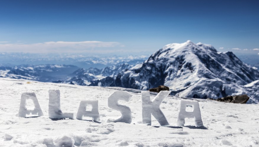
Largest state: Alaska, northwest of Canada, is the largest and most sparsely populated U.S. state with 1,718 million km² of area.
Smallest state: Rhode Island is the smallest state in the United States by area with 3,144 km2.

National bird: The bald eagle is both the national bird and national animal of the United States of America. The bald eagle appears on its seal. In the late 20th century it was on the brink of extirpation in the contiguous United States.

National anthem: The Star-Spangled Banner» is the national anthem of the United States. The lyrics come from the Defence of Fort M’Henry, a poem written on September 14, 1814, by the then 35-year-old lawyer and amateur poet Francis Scott Key after witnessing the bombardment of Fort McHenry by British ships of the Royal Navy in Baltimore Harbor during the Battle of Baltimore in the War of 1812. You can read the lyrics here: https://www.youtube.com/watch?v=FqxJ_iuBPCs
Associate territories: The Marshall Islands are associated with the United States since October 21, 1986.
United States provides defence, funding grants, and access to U.S. social services for citizens of these areas under the Compact of Free Association.
Federated State of Micronesia is associated with the United States since 3 November, 1986. Palau is associated with the United States since 1 October, 1994. These last two states associated with the United States have the same level of association as the first.
Physical features:
Area: 3,794,100 square miles (9,826,675 sq km).
Population: 325,467,306 inhabitants (2017 estimate).
Different regions:
- Northeast: it includes Maine, Massachusetts, Rhode Island, Connecticut, New Hampshire, Vermont, New York, Pennsylvania, New Jersey, Delaware and Maryland.
- Southeast: it includes West Virginia, Virginia, Kentucky, Tennessee, North Carolina, South Carolina, Georgia, Alabama, Mississippi, Arkansas, Louisiana and Florida.
- Midwest: it includes Ohio, Indiana, Michigan, Illinois, Missouri, Wisconsin, Minnesota, Iowa, Kansas, Nebraska, South Dakota and North Dakota.
- Southwest: it includes Texas, Oklahoma, New Mexico and Arizona.
- West: it includes Colorado, Wyoming, Montana, Idaho, Washington, Oregon, Utah, Nevada, California, Alaska and Hawaii.
Physical relief:
Mountains:
- Appalachian Mountains: also called Appalachians, great highland system of North America, the eastern counterpart of the Rocky Mountains. Extending for almost 2,000 miles (3,200 km) from the Canadian province of Newfoundland and Labrador to central Alabama in the United States, the Appalachian Mountains form a natural barrier between the eastern Coastal Plains and the vast Interior Lowlands of North America.
2. Rocky Mountains: mountain range forming the cordilleran backbone of the great upland system that dominates the western North American continent. Generally, the ranges included in the Rockies stretch from northern Alberta and British Columbia southward to New Mexico, a distance of some 3,000 miles (4,800 km).
3. Sierra Nevada: major mountain range of western North America, running along the eastern edge of the U.S state of California. Its great mass lies between the large Central Valley depression to the west and the Basin and Range province to the east. Extending more than 250 miles (400 kilometres) northward from the Mojave Desert to the Cascade Range of northern California and Oregon.

Climate:
However, in general it has a continental climate, with cold winters (often frigid) and hot summers (sometimes very hot), more or less continental depending on the latitude and the distance from the sea. There are, however, some exceptions: on the west coast overlooking the Pacific Ocean, the climate is cool and damp in the northern part and Mediterranean in the southern part; on the coast of the Gulf of Mexico the climate is mild in winter and hot and muggy in summer, while in Florida it is almost tropical.
In winter: in the northern and mountainous areas, pack cold weather clothing, synthetic thermal long underwear, a down filled parka with insulated hood, gloves, warm boots, winter hat; T-shirts and light shirts for hot indoor environments.
In New York, pack a down jacket, gloves, a scarf, a hat.
In the Seattle area and the north-west coast, pack warm clothes, winter coat, a raincoat or umbrella.
In Los Angeles and Miami, clothes for spring and autumn, an umbrella.
In the southern states and northern Florida, clothes for spring and autumn, but also warm clothes and a warm jacket for short cold spells.
In summer: in the northernmost areas, pack light clothing, T-shirts for hot days, a jacket and sweatshirt for the evening and cool days, a raincoat or umbrella.
On the west coast, down to San Francisco, clothes for spring and autumn: a T-shirt, a shirt, a jacket, a sweatshirt or sweater.
In New York, Chicago, Boston and Washington: light clothing, a T-shirt, a jacket and a sweater for the evening and cool days, an umbrella, a sweatshirt and pashmina for airconditioned places.
In desert areas and all of the southern belt: lightweight and loose-fitting clothing, a sun hat, a sweatshirt and pashmina for airconditioned places, comfortable and breathable shoes; in Florida and the southern states, an umbrella or lightweight rain gear; in the deserts, a light scarf for the wind full of dust.
In mountainous national parks: hiking shoes, a jacket and sweatshirt or sweater for the evening, sunscreen, sunglasses, hiking boots, an umbrella or raincoat.
Rivers: The rivers we think that the most important.
- Mississippi: The Mississippi River is one of the most important rivers in the United States. It flows 2,340 miles north to south from Minnesota to the Gulf of Mexico in Louisiana. Together with the Missouri River, it forms the fourth largest river system in the world. The source of the Mississippi is Lake Itasca in Minnesota. In the early history of the United States, the Mississippi River served as the westernmost border of the country until the Louisiana Territory was purchased from France in 1803. After that, the river was a symbol of the start of the American frontier. Today the river is an important transportation waterway, carrying goods from the middle of the country to the port of New Orleans and into the Gulf of Mexico.
- Missouri:
The Missouri River is the longest river in the United States at 2,540 miles long. Together with the Mississippi River, it forms the fourth largest river system in the world. It begins in Western Montana and flows to the Mississippi River just north of St. Louis. It travels through several states including Montana, North Dakota, South Dakota, Iowa, Nebraska, Kansas, and Missouri. - Rio Grande:
- The Rio Grande flows 1,900 miles from Colorado to the Gulf of Mexico. Along the way it travels through New Mexico and serves as the southern border of Texas between the United States and Mexico. Major tributaries of the Rio Grande include the Rio Conchos, the Rio Chama, and the San Juan River.

Lakes: The lakes we think are the most important.
- Lake Superior: The largest lake in the US and the biggest among the Great Lakes of North America, Lake Superior spans an area of 82,103 km2, roughly the size of Austria or the US state of South Carolina. The US states of Minnesota, Michigan, and Wisconsin share the Lake Superior with the Canadian province of Ontario. The lake is famous for being the largest freshwater lake in the world by surface area. The average depth of the Lake Superior is 147 m, and it holds enough water to submerge the entire Americas under 30 cm of water.
- Lake Huron: The Lake Huron, ranking second among the largest lakes in the US, spans an area of 59,590 km2 and has the longest shoreline (6,157 km) among the Great Lakes. Lake Huron and Lake Michigan are connected to each other via the Straits of Mackinac while the former is linked to the Lake Superior through the St. Mary’s River. Lake Huron hosts the largest freshwater island in the world, the Manitoulin Island.
- Lake Michigan: Lake Michigan, occupying an area of 58,026 km2, is the only Great Lake that lies entirely within the boundaries of the US. The lake ranks third among the largest lakes in the US and is roughly the size of the US state of West Virginia. The US states of Michigan, Illinois, Indiana, and Wisconsin share the lake. The shores of Lake Michigan are heavily populated with nearly 12 million people living in the region
General information about 3 states that we have chosen:
- California: California is a state in the western United States. It is the third largest state in size. It is the state with the most people living in it. Largest cities are Los Angeles, San Diego,San Jose, and San Francisco. The capital is Sacramento. It became a state on September 9, 1850. It is bordered by Arizona to the southeast, Oregon to the north, Nevada to the east and the Mexican state of Baja California to the south.
The geography of California varies depending on region. Southwestern California has small mountain ranges and the cities of San Diego and Los Angeles. Southeastern California has the Mojave Desert and Death Valley, the lowest place in the United States. The eastern part of the state has the highest point in the United States outside of Alaska, Mount Whitney, in the Sierra Nevada mountain range.
California’s climate varies widely from desert to alpine depending on latitude, elevation and how close the area is to the coast. Most of the coastal and southern parts of the state have a Mediterranean climate with somewhat rainy winters and dry summers. The deserts in the south of the state have very hot summers and mild winters. Parts of the south have a semi-arid/steppe climate, for example San Diego.

2. Georgia: Georgia is a state in the Southeastern United States. It began as a British colony in 1733, the last and southernmost of the original Thirteen Colonies to be established. Named after King George II of Great Britain, the Province of Georgia covered the area from South Carolina south to Spanish Florida and west to French Louisiana at the Mississippi River.
The state’s northernmost part is in the Blue Ridge Mountains, part of the Appalachian Mountains system. The Piedmont extends through the central part of the state from the foothills of the Blue Ridge to the Fall Line, where the rivers cascade down in elevation to the coastal plain of the state’s southern part. Georgia’s highest point is Brasstown Bald at 4,784 feet (1,458 m) above sea level; the lowest is the Atlantic Ocean. Of the states entirely east of the Mississippi River, Georgia is the largest in land area.
The majority of the state is primarily a humid subtropical climate. Hot and humid summers are typical, except at the highest elevations. The entire state, including the North Georgia Mountains, receives moderate to heavy precipitation, which varies from 45 inches (1143 mm) in central Georgia to approximately 75 inches (1905 mm) around the northeast part of the state. The degree to which the weather of a certain region of Georgia is subtropical depends on the latitude, its proximity to the Atlantic Ocean or Gulf of Mexico, and the elevation

3. Washington: Washington is the 18th largest state, with an area of 71,362 square miles (184,827 km2), and the 13th most populous state, with more than 7.4 million people.
The remainder of the state consists of: deep temperate rainforests in the west; mountain ranges in the west, central, northeast, and far southeast; and a semi-arid basin region in the east, central, and south, given over to intensive agriculture. Washington is the second most populous state on the West Coasts and in the Western United States, after California. Mount Rainier, an active stratovolcano, is the state’s highest elevation, at almost 14,411 feet (4,392 meters), and is the most topographically prominent mountain in the contiguous United States.
A Mediterranean Climate predominates in western Washington, and a much drier semi-arid climate prevails east of the Cascade Range. Major factors determining Washington’s climate include the large semi-permanent high pressure and low pressure systems of the north Pacific Ocean, the continental air masses of North America, and the Olympic and Cascade mountains. In the spring and summer, a high pressure anticyclone system dominates the north Pacific Ocean, causing air to spiral out in a clockwise fashion. For Washington, this means prevailing winds from the northwest bring relatively cool air and a predictably dry season.

https://statesymbolsusa.org/symbol-or-officially-designated-item/state-motto/god-we-trust
https://www.britannica.com/place/Appalachian-Mountains
https://www.ducksters.com/geography/us_states/us_rivers.php
https://www.worldatlas.com/articles/the-largest-lakes-in-the-us.html
https://state.1keydata.com
https://en.m.wikipedia.org/wiki/List_of_capitals_in_the_United_States
https://www.timeanddate.com/holidays/us/independence-day
